


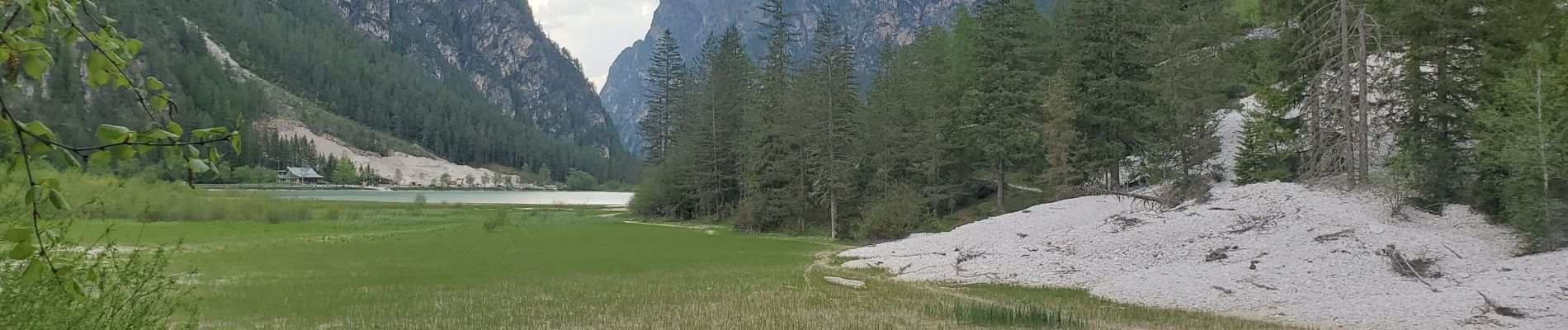
lac de landro

Danielba
User GUIDE
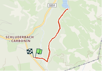

Length
3.6 km

Max alt
1477 m

Uphill gradient
66 m
Km-Effort
4.5 km

Min alt
1408 m

Downhill gradient
67 m
Boucle
Yes
Creation date :
2025-06-01 15:29:30.144
Updated on :
2025-06-05 16:41:52.555
1h11
Difficulty : Easy

FREE GPS app for hiking
 SityTrail
IGN / Geographical institutes
SityTrail Plus
The world is yours!
About
Trail Walking of 3.6 km to be discovered at Trentino-Alto Adige/Südtirol, South Tyrol, Toblach - Dobbiaco. This trail is proposed by Danielba .
Photos

Positioning
Country:
Italy
Region :
Trentino-Alto Adige/Südtirol
Department/Province :
South Tyrol
Municipality :
Toblach - Dobbiaco
Location:
Unknown
Start:(Dec)
Start:(UTM)
287335 ; 5166301 (33T) N.
Comments
balade à plat dans une forêt de pins un peu maigre